


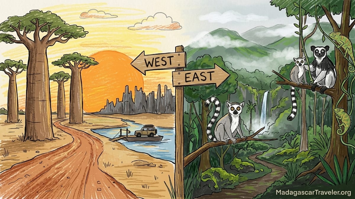
If you cannot fit both sides of Madagascar into a single journey, you are not alone. Most travelers eventually face the same decision: commit to the wild, baobab-studded west with its rough 4x4 tracks and expedition feel, or opt for the lusher, easier-to-reach eastern rainforests with classic lemur watching and greener landscapes. Both are memorable. They simply offer a very different kind of adventure.
Big Picture: Two Very Different Madagascars
Western Madagascar feels like an overland expedition. Think dusty laterite tracks, sunset silhouettes of giant baobabs, days of bumping along in a 4x4 and river crossings on basic barges. Travellers typically access the region via Morondava on the Menabe coast, then push north toward Kirindy Forest and Tsingy de Bemaraha or south toward Belo sur Mer and Kirindy Mitea. Distances do not look huge on the map, but poor road surfaces and slow average speeds make every transfer a serious travel day.
Eastern Madagascar, by contrast, is about humid air, rolling hills and cloud forest. Andasibe Mantadia National Park, roughly three to four hours by paved road from Antananarivo along the RN2, is the classic first-timer’s destination, with comfortable lodges, short rainforest trails and remarkably approachable lemur watching. Many visitors extend on to the Pangalanes Canal or the coast at Toamasina or Mahambo, but even a short loop from the capital gives a satisfying taste of rainforest Madagascar without multi-day off-road driving.
Your fundamental choice is therefore between a more physically demanding, logistically complex west that delivers some of Madagascar’s most iconic landscapes, and a greener, more accessible east that prioritizes close wildlife encounters. Time, budget, and appetite for rough travel usually decide it. If you have under 10 days, limited tolerance for long, bumpy drives, or you are traveling with very young children, the east usually wins. With 12 to 16 days, reasonable fitness and a taste for adventure, the west can become the heart of your trip.
Landscapes: Baobabs and Tsingy vs Cloud Forest and Mist
The west has some of the most recognisable scenery on the continent. The Avenue of the Baobabs near Morondava delivers exactly the postcard image many people hold of Madagascar: a dirt road lined with massive Grandidier’s baobabs rising from a flat, dry plain. Sunrise and sunset are the most atmospheric times, when oxcarts, zebu herds and local cyclists pass through the silhouettes. Continuing inland, Kirindy Forest and Kirindy Mitea protect dry deciduous forest, thorny scrub and coastal dunes. Farther north, Tsingy de Bemaraha’s needle-like limestone formations create a landscape that feels almost alien, with hanging bridges, narrow canyons and viewpoints over a forest of stone pinnacles.
In the east, it is all about green. Andasibe Mantadia and nearby reserves like Analamazaotra and Mitsinjo protect dense mid-altitude rainforest, often shrouded in morning mist. Trails wind under tall tree ferns and moss-covered trunks, with waterfalls, small streams and clear forest pools. The landscapes are less obviously dramatic than the west’s baobab avenues or tsingy pinnacles, but they feel intensely alive. Many travelers recall the soundscape as much as the views: indri calls echoing over the valley, tree frogs at night, and rain drumming on lodge roofs.
If iconic photographs are your priority, the west has the edge. A wide-angle shot of Avenue of the Baobabs at sunset or a climber crossing a suspended bridge above jagged grey tsingy is instantly recognisable. If you are more drawn to moody, atmospheric forest scenes, macro details of orchids and chameleons, and rolling hills under low cloud, the east’s rainforest landscapes may be more your style.
Wildlife: Lemur Encounters vs Broad but Subtle Biodiversity
For many visitors, the question is simple: where will I actually see lemurs? In practice, both coasts deliver, but the experiences differ. Around Andasibe in the east, habituated groups of indri, common brown lemurs and diademed sifakas are routinely seen on short, half-day walks. Local guides often know individual family groups and can lead you to them within an hour of leaving the park gate. Night walks along the road and community-managed forest edges regularly produce tiny mouse lemurs, woolly lemurs, chameleons and leaf-tailed geckos. For a first trip, the reliability of these encounters is a strong argument in favor of the east.
Western Madagascar’s wildlife is more skewed to dry forest specialists and a mix of charismatic and more cryptic species. Kirindy Forest is one of the most productive sites to search for the fossa, Madagascar’s largest predator, as well as Verreaux’s sifaka, red-fronted brown lemur, giant jumping rats and numerous nocturnal lemurs. Many visitors time their trip during the austral winter and spring, when daytime temperatures are manageable and night walks are rewarding. Tsingy de Bemaraha hosts Decken’s sifakas, red-fronted brown lemurs and a variety of cave-adapted bats and reptiles, but sightings usually involve steeper trails and some basic scrambling.
If you travel with children or anyone who wants high chances of close lemur encounters without long hikes, Andasibe and the eastern rainforests are the safer bet. Several lodges have resident or semi-habituated lemurs that wander through the gardens, and short, flat trails are common. In the west, wildlife viewing can be just as rich but often requires longer walks in hotter, drier conditions and a bit more patience. Birders and reptile enthusiasts often appreciate both coasts, but will find eastern sites better for rainforest endemics and western sites better for dry-forest and wetland species around Kirindy Mitea and coastal mangroves.
Road Difficulty and Logistics: From Paved RN2 to West Coast 4x4 Tracks
The most practical difference between east and west is road difficulty. Andasibe and the surrounding eastern reserves are reached via the RN2, Madagascar’s main artery to the port of Toamasina. It is fully paved and, although traffic is slow and there are potholes, private drivers and taxi-brousses use it daily. From Antananarivo, a private car with driver will usually take around three to four hours to reach Andasibe, longer in heavy truck traffic. Once there, access roads to major lodges are short and usually passable in a standard car for most of the dry season. You may feel tired at the end of the drive, but not beaten up.
Reaching western highlights is another story. Morondava itself sits at the western end of a paved road from the central highlands, but internal flights are irregular and subject to delays, and overland journeys from Antananarivo can take a full day or more in each direction. From Morondava to Kirindy Forest, drivers follow the RN8 past the Avenue of the Baobabs. Recent travelers frequently describe large potholes and slow going, with the 60-kilometer stretch taking two to three hours in a 4x4. Continuing north toward Bekopaka for Tsingy de Bemaraha means unpaved tracks, seasonal river ferries and travel days that can stretch to seven or nine hours depending on conditions and stops.
Southern Menabe, including Belo sur Mer and Kirindy Mitea National Park, is even more remote. Access typically requires a half-day 4x4 transfer or a chartered boat along the coast. During the rainy season roughly December to March, some tracks become deeply rutted or impassable, and river crossings may be closed for days at a time. Guides and local drivers keep a close eye on conditions and often adjust itineraries at short notice. If your idea of a holiday does not include eight hours in a Land Cruiser on corrugated dirt, the east will feel much more comfortable.
Trip Length and Itinerary Shapes
With 7 to 10 days in Madagascar, the east lends itself to straightforward, efficient itineraries. A common pattern for first-time visitors is two nights in Antananarivo, three or four nights around Andasibe Mantadia, and perhaps two nights at a secondary stop such as the Palmarium Reserve on the Pangalanes Canal or a simple beach stay on the east coast. This pace allows multiple day and night walks, some downtime at the lodge and buffer time for weather or traffic without making the trip feel rushed.
A similarly short trip focusing solely on the west is more challenging. Even if you fly from Antananarivo to Morondava, flight schedules are limited and sometimes change at short notice. To visit Avenue of the Baobabs, Kirindy Forest and Tsingy de Bemaraha properly, most travelers need at least eight to nine days on the ground. One realistic sample: day 1 Antananarivo to Morondava, day 2 Kirindy Forest, day 3 transfer to Bekopaka, days 4 and 5 exploring the tsingy circuits, day 6 return toward Morondava, day 7 buffer or Baobab Avenue at sunset, day 8 flight back to the capital. That assumes dry-season roads and everything running to plan.
With 14 to 16 days, you can build more generous buffers into a western itinerary or combine a lighter version of both coasts, for instance Andasibe in the east and Morondava plus Kirindy in the west. But if you only have one week and you want time to enjoy the forests rather than just endure the driving days, focusing on the east is usually more sensible. The west rewards those who can commit a bit more time and are willing to let the journey itself become a main part of the story.
Accommodation and Comfort Levels
On the eastern side, the core Andasibe area has a cluster of established lodges in and around the villages of Andasibe and Andasifahatelo. Options range from simple bungalows with hot water and mosquito nets to mid-range ecolodges with polished restaurant service and well-maintained gardens. Heated rooms are rare, but nights can be cool between June and August, and many lodges provide thick blankets. Power cuts happen, but most properties have generators or solar systems that keep lights on and device charging possible for at least part of the day.
In the west, especially away from Morondava, accommodation tends to be more rustic and spread out. Morondava itself has a handful of seafront hotels with air conditioning and pools that cater to both domestic and international visitors. Out toward Kirindy Forest, travelers typically stay either at the very simple lodge inside or adjacent to the reserve, where rooms are basic and Wi-Fi is limited or nonexistent, or at modest roadside bungalows between the forest and Morondava. In Bekopaka, near the entrance to Tsingy de Bemaraha, a small selection of mid-range hotels offers en-suite rooms, fans, cold or tepid showers and open-air restaurants, but expect intermittent electricity and limited connectivity.
Beach villages like Belo sur Mer and the fringes of Kirindy Mitea offer thatched bungalows on or near the sand, often run by small Malagasy or French-Malagasy teams. These stays can feel wonderfully remote and authentic, but water pressure, menu variety and power reliability are all a step down from what you might find around Andasibe. If you value comfort, consistent hot showers and easy dietary accommodations, the east has more choice and smoother logistics. If you want to disconnect and are comfortable trading a bit of comfort for remoteness, western lodges and simple beach hotels are part of the appeal.
Seasonality and Weather: When Each Coast Works Best
Madagascar’s seasons complicate the east versus west decision. In the west, access is strongly seasonal. The classic dry season from roughly May to October is the primary window for overland travel to Tsingy de Bemaraha and for reliable 4x4 routes along the Menabe coast. Tracks from Morondava to Bekopaka and down to Belo sur Mer can degrade into mud and deep ruts after heavy rains, and river levels can make barges unsafe. Many local operators simply do not run tsingy trips during the peak rainy months of January and February, and even December and March can be marginal depending on recent weather.
Eastern rainforests like Andasibe are accessible year-round thanks to the paved RN2, but they receive significantly more rainfall. Expect afternoon showers in most months, with heavier downpours from roughly December to March. Trails can be muddy and leeches common during the wettest period, but forests are at their greenest and frogs and reptiles are highly active. Birders and herpetologists often favor the shoulder seasons around November and March for this reason, despite the humidity. From June to August, temperatures are cooler, rain lighter and walking more comfortable, although some species, including certain reptiles, are less visible.
If your trip falls in the height of the rainy season and you have to choose one side, the east is more likely to remain feasible and safe. Roads may slow, but they are unlikely to close fully. For travel between May and October, both coasts are options. Families and travelers who prefer milder temperatures often choose the east in July or August, while those chasing tsingy pinnacles, baobab sunsets and dry-forest mammals make the most of the western dry-season window.
Budget and Real-World Costs
Budget is where perceptions can be misleading. On paper, eastern destinations like Andasibe are closer to the capital and might seem cheaper. In practice, the determining factor in Madagascar is almost always transport. Hiring a private car with English-speaking driver for the RN2 corridor is a substantial daily cost, but distances are shorter and fuel consumption lower than on rough west-coast tracks. Many travelers report paying a mid-range daily rate that covers vehicle, driver, fuel and their driver’s accommodation on typical east-side itineraries, on top of lodge stays that can range from modest guesthouses to comfortable ecolodges.
Western itineraries almost always cost more day by day once you leave Morondava. You will need a high-clearance 4x4, often at a premium daily rate compared with a sedan, and fuel consumption increases dramatically on slow dirt roads. Long days to and from Bekopaka or Belo sur Mer involve paying the driver, covering their food and lodging, and paying for river ferries or boat transfers. In addition, park entrance fees and mandatory local guiding costs at Tsingy de Bemaraha and Kirindy Forest can feel higher simply because you are often doing full-day circuits and night walks. Food and lodging in Bekopaka and other remote western villages can be relatively expensive for the level of comfort, because almost everything must be transported in.
If you are traveling on a tighter budget, you can manage costs more effectively in the east by basing yourself in one or two hubs like Andasibe and using local guides for day trips. It is possible, for example, to arrange shared transfers or use higher-quality taxi-brousse services from the capital to the Andasibe area, although this adds time and reduces flexibility. In the west, shared tourist 4x4s to Tsingy do exist, particularly in peak season, but they require flexibility on dates and a willingness to compromise on pace. For many independent travelers, the safer financial choice is to concentrate resources on doing one coast well rather than trying to split time and budget between both.
The Takeaway
If your mental image of Madagascar is a sun setting behind enormous baobabs, dust in the air, and a sense that simply reaching your destination is an adventure, the western route to Morondava, Kirindy and Tsingy de Bemaraha matches that dream. It demands more travel time, a bigger transport budget, and a higher tolerance for uncertainty, but the rewards are uniquely dramatic landscapes, encounters with dry-forest wildlife and the feeling of having made a real journey across one of Africa’s least developed road networks.
If, instead, you picture lush rainforest, indri songs carrying through the mist, short walks that reliably reveal lemurs and chameleons, and lodges that are rustic but comfortable after three or four manageable hours of driving from the capital, then Eastern Madagascar is likely your best choice. For many first-time visitors with 7 to 12 days, especially families, older travelers and those wary of long off-road days, focusing on Andasibe and nearby reserves provides a rich and achievable introduction to the island.
Whichever side you choose, success hinges on honest planning. Be realistic about how many hours of rough driving you actually want, what level of accommodation you will be happy with, and how much buffer time you can afford for weather or flight changes. In a country where infrastructure can change from one season to the next, it is often better to pick one coast, slow down and experience it fully than to rush between both and spend more time in the vehicle than on the trail.
FAQ
Q1. If I have 8 days in Madagascar, should I choose the west or the east?
If you have around 8 days, the east is usually the better fit. You can reach Andasibe from Antananarivo in roughly three to four hours on a paved road, spend several days walking in the rainforest and still keep buffer time for weather or traffic. An 8-day western itinerary that includes Tsingy de Bemaraha is possible but tight, with long 4x4 days and more risk of disruption if flights or road conditions change.
Q2. How rough are the roads to Tsingy de Bemaraha compared with the road to Andasibe?
The road to Andasibe follows the RN2, a paved national route with potholes and slow trucks but no river crossings. The route from Morondava to Tsingy de Bemaraha involves unpaved tracks, corrugations, deep potholes and seasonal river ferries. Travel days can easily stretch to seven or more hours in a 4x4 for distances that look short on the map, and conditions deteriorate significantly in or after heavy rain.
Q3. Where am I more likely to see indri and other lemurs up close?
Indri and several other lemur species are much easier to see up close in the eastern rainforests around Andasibe. Local guides can often locate habituated groups of indri and diademed sifaka within an hour of entering the forest, and night walks regularly produce mouse lemurs, chameleons and geckos. In the west, you will see lemurs as well, especially sifakas and brown lemurs, but encounters are generally less predictable and often involve longer walks in hotter conditions.
Q4. Is Western Madagascar safe to visit for independent travelers?
Western Madagascar is generally safe for careful independent travelers, but it is logistically more complex. Long, rough roads, river crossings and limited infrastructure mean you should almost always travel with a reliable local driver and guide rather than self-drive. Basic precautions apply as in any rural destination: avoid driving at night, secure valuables, and keep plans flexible to accommodate road or weather disruptions.
Q5. Can families with young children handle a west-coast itinerary?
Families with young children can visit the west, but they need to be realistic about long, hot driving days and limited facilities. Many parents find that children tolerate the three to four hour drive to Andasibe much better than 7 to 9 hour days on rough tracks around Morondava and Tsingy de Bemaraha. If you have children under about 8 years old and only one trip to Madagascar, the east’s shorter transfers and easier trails usually make for a calmer holiday.
Q6. What is the best season to see wildlife in the east versus the west?
In the east, wildlife is good year-round, with particularly lively bird and reptile activity in the wetter months and early dry season. Trails can be muddy between December and March but forests feel very alive. In the west, the dry season from roughly May to October is best, when access to Tsingy de Bemaraha and coastal areas is more reliable and temperatures are more comfortable for long walks. Many operators do not run tsingy trips in the peak rainy months because tracks and river crossings become unsafe.
Q7. How much more expensive is a typical western itinerary than an eastern one?
Exact costs vary by season and exchange rates, but western itineraries almost always cost more per day once you leave Morondava because you need a 4x4, burn more fuel and cover your driver’s food and accommodation on long transfer days. Park and guiding fees at Tsingy de Bemaraha and Kirindy are similar in scale to those in major eastern reserves, but remoteness pushes up transport and supply costs. Eastern trips centered on Andasibe can use shorter transfers and, in some cases, shared transport, making it easier to manage on a tighter budget.
Q8. Is it still worth going west if I cannot fit Tsingy de Bemaraha into the itinerary?
Yes, the west is still worthwhile even without Tsingy de Bemaraha. A shorter itinerary that focuses on Morondava, Avenue of the Baobabs, Kirindy Forest and possibly Kirindy Mitea or Belo sur Mer can deliver baobab sunsets, dry-forest wildlife and quiet beaches with fewer ultra-long driving days. It will still feel more adventurous than an eastern itinerary, but the logistics are less demanding than pushing all the way to Bekopaka.
Q9. Can I realistically combine Andasibe in the east with Morondava and Kirindy in one trip?
Combining Andasibe with Morondava and Kirindy is realistic on a trip of around 12 to 16 days, especially if you are willing to fly at least one leg between the west coast and the capital. A sample pattern is to start with a few days in Andasibe, return to Antananarivo, then fly or drive to Morondava for Avenue of the Baobabs and Kirindy. Trying to add Tsingy de Bemaraha as well on a shorter trip often leaves little time to actually enjoy the parks.
Q10. If I care most about photography, which side should I prioritize?
If your primary goal is dramatic, instantly recognisable images, the west has a slight edge thanks to Avenue of the Baobabs, tsingy pinnacles and dry-season sunsets over dusty tracks and rivers. However, the east excels for moody rainforest scenes, close-up wildlife portraits and macro shots of frogs, chameleons and orchids. Photographers who prefer intimate, animal-focused work often favor the east, while those drawn to big landscapes and the sense of expedition gravitate to the west.